Chasing the Extremes Across New Mexico
A dedicated storm chasing unit, weather spotters, and field operatives tracking supercells, dryline tornadogenesis, and intense monsoons across the high plains and desert canyons of New Mexico.
6 Chasers
Active Command
High Desert & Plains
Operational Area
Ground-Truth
Real-Time Reports
Field Operations & Broadcast Center
Continuous meteorological telemetry, high-definition Doppler composite radar, and live field chase broadcasts.
Live Community Storm Reports Feed
Real-time ground-truth severe weather reports submitted by spotters, field chasers, and local New Mexico residents.
Forecast Intelligence & SPC Weather Lab
Frontline convective outlooks, live Storm Prediction Center risk contours, Caprock dryline targeting, and real-time upper-air sounding telemetry.
Directly synchronized with NOAA's Storm Prediction Center (Day 1 Convective Outlook). Forecaster: GUYER • Valid today across New Mexico.
Operational Status: No organized severe weather or discrete supercell risk is forecast for New Mexico today by NOAA SPC. Widely scattered non-severe or pulse diurnal thunderstorms may develop over high terrain. NMCP field intercept crews are on situational standby.
Official raw atmospheric vertical soundings from regional NWS balloon launches measuring lapse rates, CAPE, CIN, and hodograph helicity.
New Mexico Dryline & Mesonet Surface Station Board
| Station | Location / Sector | Temp | Dewpoint (Td) | RH | Wind Vector | Pressure / Trend | Moisture Classification |
|---|
Meet Our Chasing Team
United by discipline, advanced meteorological analysis, and frontline storm intercept experience.
Dustin Garner
Directs organizational operations, intercept strategy, team logistics, media coordination, and comprehensive project vision across all New Mexico chase corridors.
✉️ dustin@newmexicochasersproject.comCarlos Reyes
In command of on-the-ground tactical execution, convoy positioning, and real-time safety protocols during volatile high-risk severe storm environments.
✉️ charls@newmexicochasersproject.comAiden Nelson
Supervises unit operations and manages communications networks, radar synchronization, telemetry data, and tactical convoy coordination in the field.
✉️ aiden@newmexicochasersproject.comTravis Johnson
Leads the SWS team in regional storm tracking, radar monitoring, and real-time severe weather statement relays. Coordinates live weather surveillance and vital ground-truth updates across high-risk corridors.
Douglas Levy
Veteran High Plains chaser with 10+ years of severe weather spotting across eastern New Mexico. Brings deep regional terrain knowledge, science education background, and precision tactical navigation to the frontline convoy.
✉️ douglas@newmexicochasersproject.comAngel Fernandez
Executes precision vehicle operations, high-speed regional road navigation, and real-time ground-truth weather spotting during active convective chase days.
✉️ angel@newmexicochasersproject.comJustin Grady
Undergoing tactical field training, route reconnaissance, observation logging, and vital operational support for NMCP severe storm intercept missions.
Project Director
Strategic Planning, Project Overview
Team Captain
Field Command, Safety Lead
Lieutenant
Unit Supervision, Comms
Met-Lead / Specialist
Weather Forecasting, Data Analysis
Senior Chaser
Advanced Chase Operations, Field Deployment
Chaser
Team Vehicle Operations, Real-Time Reporting
Spotter
Weather Observation, Field Reporting
Apprentice
Field Training, Operational Support
New Mexico Storm Spotter Field Guide & Safety Matrix
Essential cloud morphology identification, official severe hail metrics, and high-desert intercept survival guidelines tailored for the rugged terrain of New Mexico.
An abrupt, persistent, localized lowering beneath the rain-free base of a supercell. Positioned in the main updraft/inflow quadrant. Inflow bands and "tails" often feed into it.
A menacing, expansive horizontal wedge or shelf arching along the leading edge of a thunderstorm's gust front. Appears on the forward flank, accompanied by sudden cool wind gusts.
Ragged, fragmented cloud scraps condensing in high-humidity ambient air beneath rain shafts. Scud clouds frequently rise, twist, or dart quickly due to turbulent outflow winds.
A rare, horizontal, tube-shaped cloud completely detached from the thunderstorm base. Appears to tumble or roll slowly along an outflow boundary or microburst edge.
Unpaved county roads in Harding, Quay, De Baca, Roosevelt, and Lea counties are composed of dense caliche and bentonite clay. When rain touches them, they instantly become slicker than ice. Even aggressive 4WD and AWD vehicles lose traction within seconds and slide into deep bar ditches.
New Mexico's parched desert soil cannot absorb deluge precipitation. Massive storm runoffs funnel into dry arroyos, sending 4-to-8 foot walls of muddy water roaring across highways miles away under clear sunny skies. Low-water crossings are frequently swept away.
The Llano Estacado Caprock forms a vertical 200–500 ft sheer escarpment dividing the eastern plains from the central valleys. Roads ascending the Caprock (such as NM-209 near Broadview or NM-268) are steep, switchbacked, and have zero side shoulders. Chasers can easily get trapped against the wall if a supercell approaches.
Operating at 4,000 to 7,500+ ft above sea level reduces the air column between storm bases and the ground. High plains mesas act as elevated grounding rods. Positive "bolts from the blue" routinely strike 10–15 miles outside the rain core under sunny skies.
NMCP Field Media & Storm Archive
High-definition photography, 4K chase videography, and atmospheric intercept chronicles documenting supercells, tornadogenesis, and high-desert lightning across New Mexico.
All photographs, video captures, drone telemetry recordings, aerial scans, and field intercept media displayed on this website are the exclusive intellectual property of the New Mexico Chasers Project (NMCP) and Dustin Garner. Strict Prohibition: No image or video from this website may be downloaded, reproduced, broadcast, mirrored, republished, cropped, watermarked, or utilized in any public, commercial, television, digital publication, or social media distribution without prior written consent and formal licensing approval from NMCP.
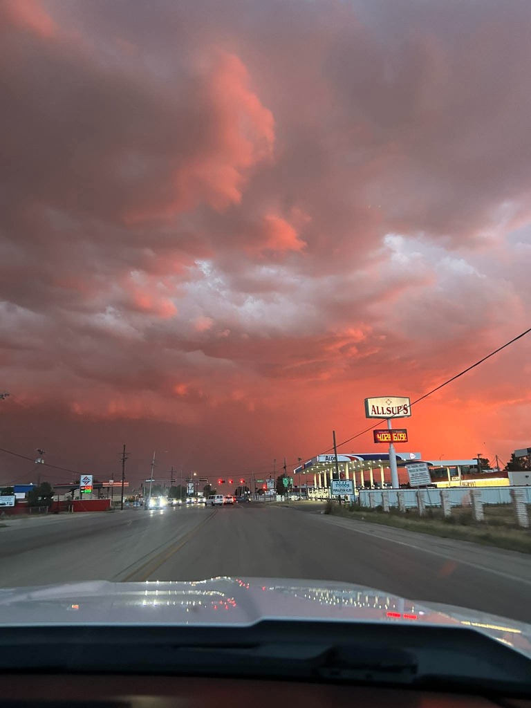
Hobbs Crimson Sunset Supercell
Vibrant crimson and copper sunset illumination beneath a convective storm base and mammatus canopy rolling over Hobbs, NM.
Inspect in Media Archive →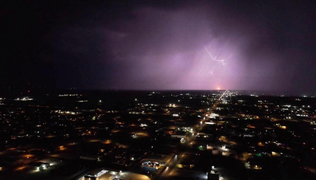
Hobbs Nocturnal Lightning & City Grid
Elevated night perspective of Hobbs city lights beneath a massive nocturnal thunderstorm illuminating the anvil and spider lightning.
Inspect in Media Archive →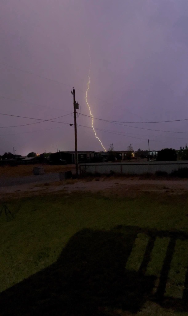
Hobbs Vertical CG Lightning Bolt
Direct vertical cloud-to-ground lightning channel discharging with intense luminosity behind the utility corridor during a severe storm intercept in Hobbs.
Inspect in Media Archive →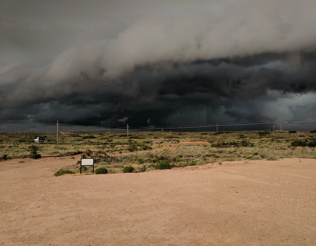
Loco Hills Severe Shelf Cloud
Massive dark, sculpted shelf cloud and outflow boundary advancing aggressively across the desert prairie outside Loco Hills along US-82.
Inspect in Media Archive →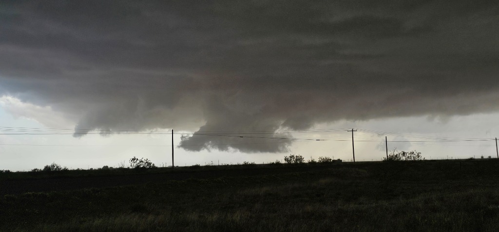
Buckeye Supercell Wall Cloud
Localized rotating wall cloud lowering beneath the dark updraft base of an isolated severe supercell near Buckeye in Lea County.
Inspect in Media Archive →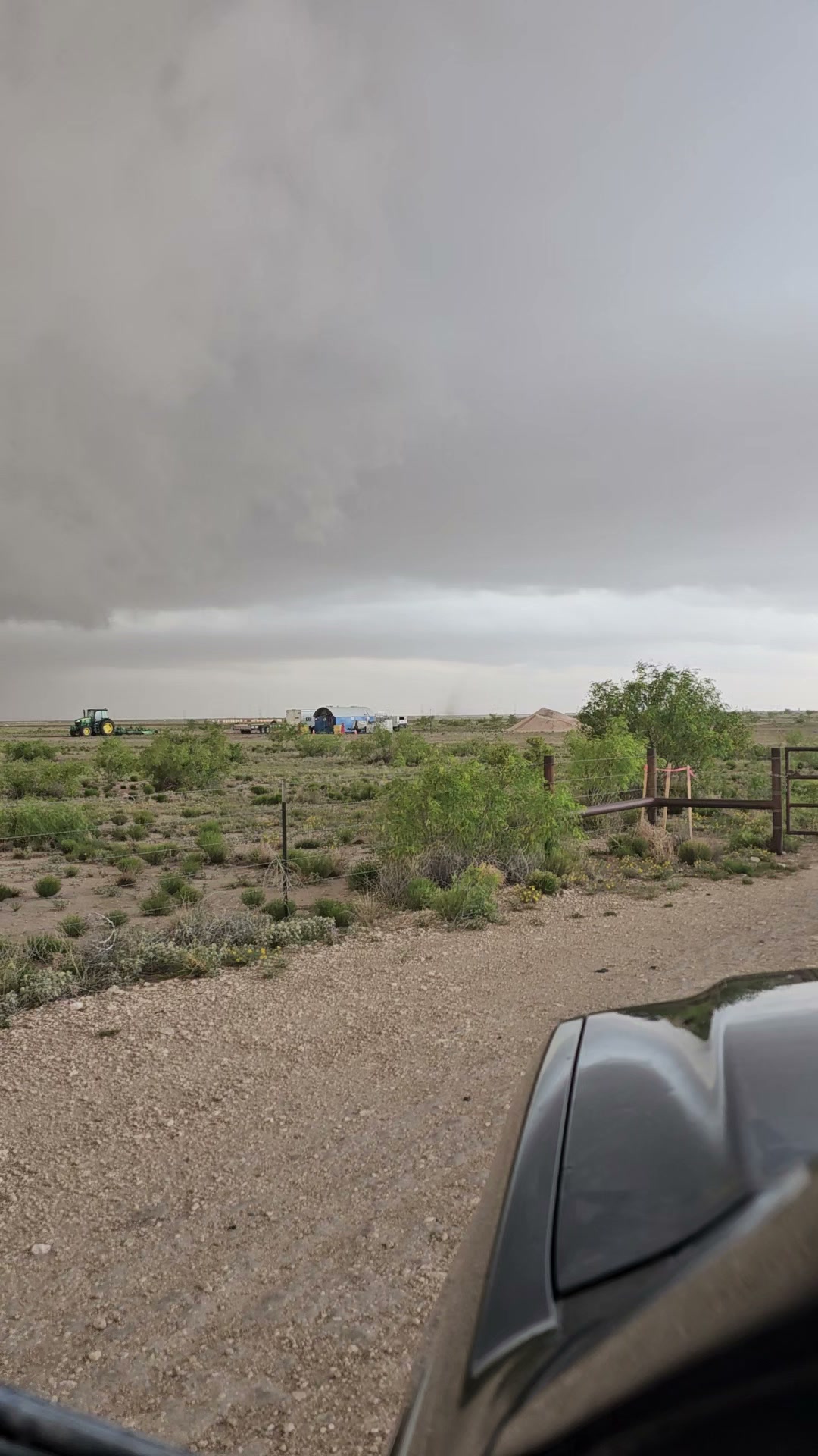
Buckeye Landspout Tornado Intercept
High-definition ground intercept of a condensing landspout vortex column spinning across the prairie near Buckeye, NM.
Watch Video Intercept →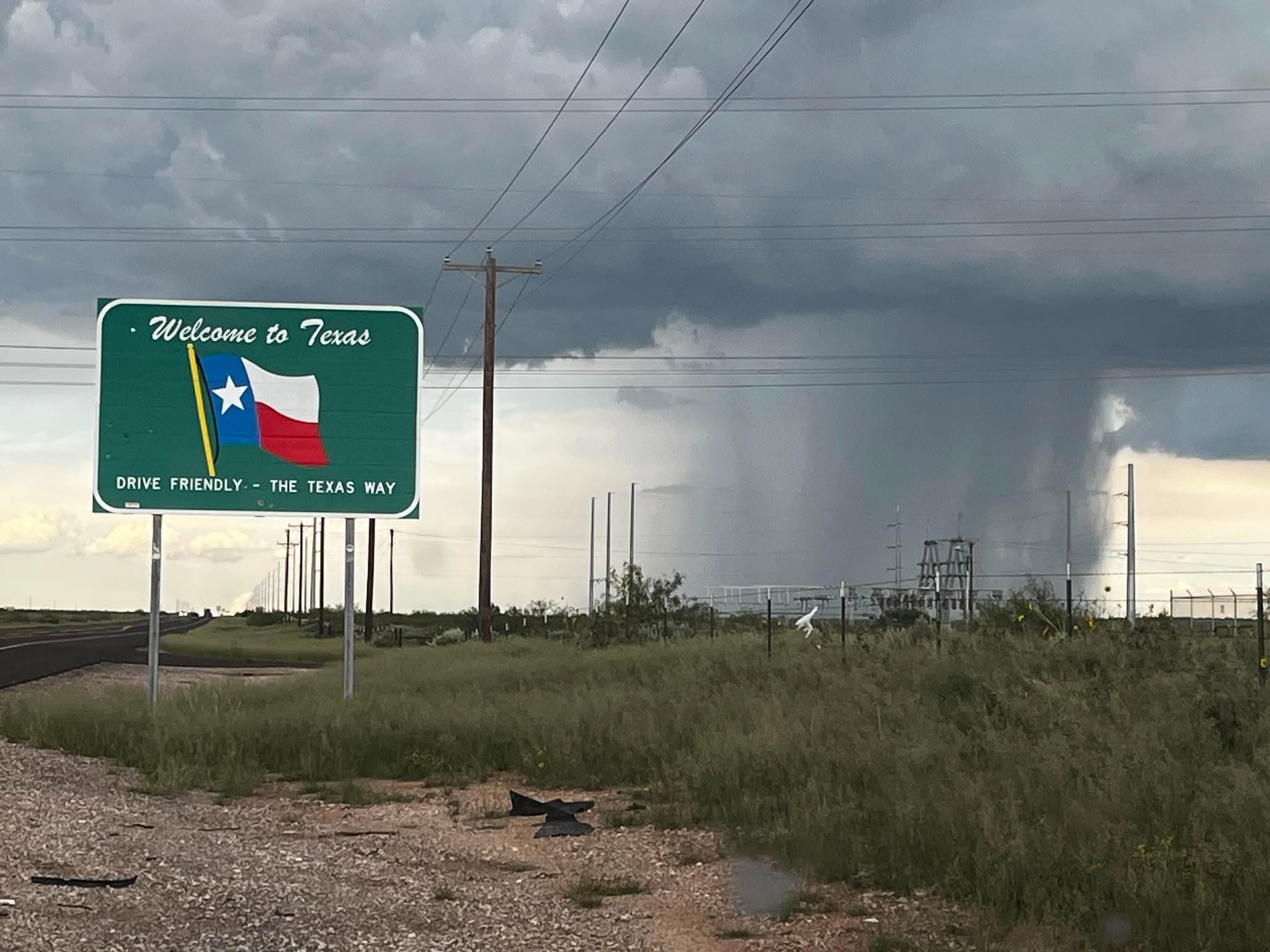
Texas Border Microburst & Funnel
State line intercept beside the Welcome to Texas marker documenting a massive microburst column and low-hanging convective lowering near Seminole.
Inspect in Media Archive →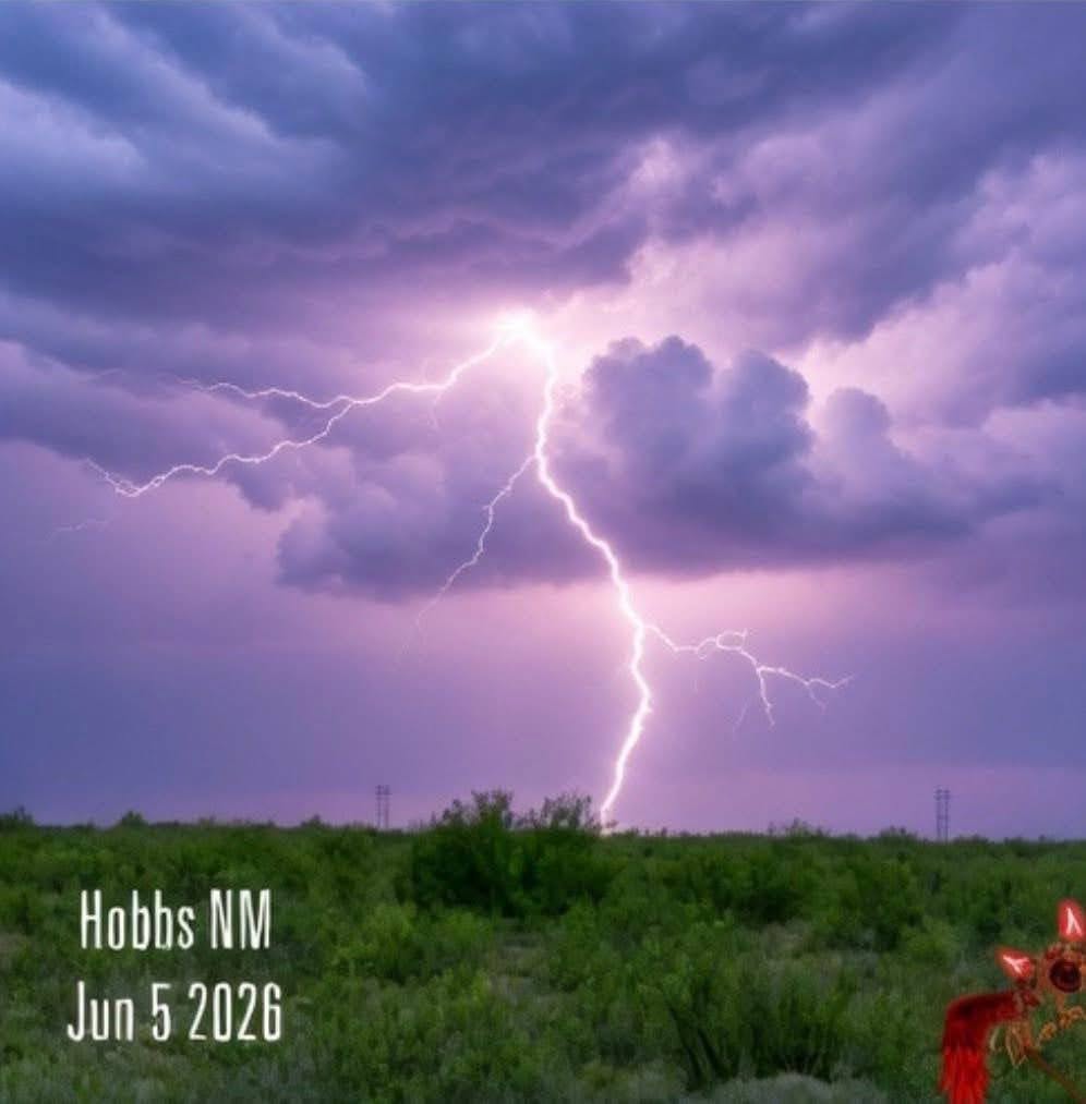
Hobbs Electric Violet Nocturnal Bolt
Stunning cloud-to-ground lightning bolt illuminating the storm anvil in deep violet and purple tones over the desert prairie outside Hobbs, NM.
Inspect in Media Archive →Contact NMCP Command
Have storm reports, ground-truth observations, media inquiries, or sponsorship opportunities? Connect directly with our command operatives and field specialists.
Dustin Garner
Project administration, media coordination, strategic planning, and overall chase operations.
✉️ dustin@newmexicochasersproject.comCarlos Reyes
Tactical convoy command, severe intercept execution, and on-the-ground safety leadership.
✉️ charls@newmexicochasersproject.comAiden Nelson
Communications network relay, radar telemetry synchronization, and unit logistics.
✉️ aiden@newmexicochasersproject.comDouglas Levy
Tactical intercept routing, frontline ground-truth weather spotting, regional road navigation, and Spotter Network reporting.
✉️ douglas@newmexicochasersproject.comAngel Fernandez
Vehicle fleet routing, high-speed regional road navigation, and real-time storm spotting.
✉️ angel@newmexicochasersproject.com🌪️ Vortex-X: Spin to EF-5
Click, tap, or mash the spacebar as fast as you can to spin up a supercell tornado from a gentle dust devil into a catastrophic EF-5 monster. Sustain maximum wind intensity to rack up massive points and dodge airborne debris!
Dust Devil
Reach EF-0 (65 MPH)
Tin Peeler
Reach EF-1 (86 MPH)
Barn Buster
Reach EF-2 (111 MPH)
"We Got Cows!"
Reach EF-3 (136 MPH)
Chaser Tosser
Reach EF-4 (166 MPH)
Finger of God
Reach EF-5 (200+ MPH)
Iron Grip
Sustain EF-5 for 5 sec
Storm Legend
Score 25,000+ points
🌪️ Severe Weather Intercept
Positioning in the right place at the right time. We track supercells, dryline boundaries, microbursts, and tornadic events across New Mexico's diverse terrain.
📡 Ground-Truth Reporting
Radar only tells part of the story. Our team provides accurate on-the-ground visual observations and reports to keep local communities informed and safe.
📸 Atmospheric Media
Documenting the raw beauty of Southwestern storms through high-resolution photography, 4K timelapse sequences, and cinematic field video.